


Located in the heart of Shanghai, Jing'an District is betting on a network of waterways to bridge its historic north-south divide and redefine what a vibrant urban neighborhood looks like in 21st-century China.
Tracing a path through the district, Zoumatang, Pengyuepu River and Suzhou Creek carve out a shape that, from above, mirrors the Greek capital letter Σ. For local planners, this mathematical symbol for "summation" offered the perfect moniker for one of Shanghai's most ambitious urban renewals: the Σ Ecological Corridor.
Spanning 13.7 kilometers with 22.6 kilometers of continuous shoreline, the corridor is the centerpiece of Jing'an District's strategic roadmap through 2030. It weaves together the district's major green spaces and blue ways, acting as a spine that simultaneously drives economic upgrades, environmental restoration, and neighborhood livability.
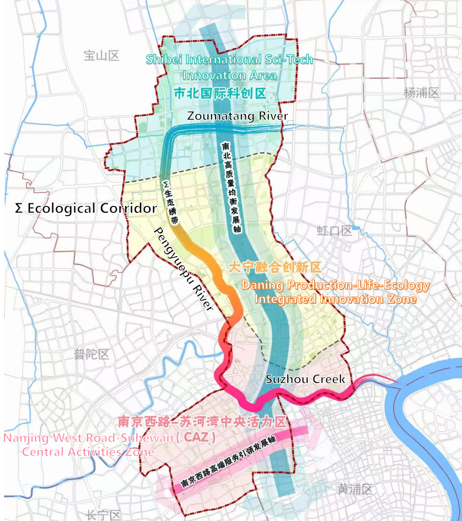
Illustration of the Σ Ecological Corridor in Jing'an District, Shanghai. (Photo provided by the interviewee)
-- Stitching together a tale of two districts
To understand why the Σ Ecological Corridor matters, consider Jing'an's backstory. In 2015, the old industrial hub of Zhabei was merged with its affluent neighbor, Jing'an District, into a single administrative zone.
The merger, however, created a striking contrast. The south is polished, premium, and packed. Home to the glittering Nanjing West Road business district, it pulses with luxury flagship stores, multinational headquarters, and iconic skyscrapers -- yet land here is scarce, and development has reached a physical ceiling.
The north, meanwhile, offers a spacious frontier for growth. Anchored by the Shibei High-Tech Park and the Daning area, it has become a magnet for future-facing industries such as data intelligence and life sciences.
By launching the Σ Ecological Corridor, Jing'an aims to dissolve these invisible boundaries. The goal is to funnel high-end services from the south, cultural and ecological assets from the center, and tech innovation from the north into a unified, high-performing ecosystem.
"As a mathematical symbol, Σ stands for summation, which aligns perfectly with Jing'an's original intention for balanced north-south development," noted an official from the Development and Reform Commission of Jing'an District.
-- Three waterways, three distinct personalities
Rather than a uniform coat of paint, the plan assigns each of the corridor's three waterways a distinct urban character.
Zoumatang River: the digital engine
Forming the top bar of the Σ, Zoumatang runs alongside the Shibei International Sci-tech Innovation Area.
Its banks were once lined with smokestacks, textile mills, and metallurgy plants -- the heavy industrial backbone of old Shanghai. Today, that industrial footprint has been replaced by the Shibei High-Tech Park, which now houses roughly one-third of Shanghai's big data companies. Inside the park, a specialized hub called "Data Link Valley" makes this digital transformation tangible, fostering a cutting-edge community for global tech innovators.
The Zoumatang waterfront. (Photo provided by the interviewee)
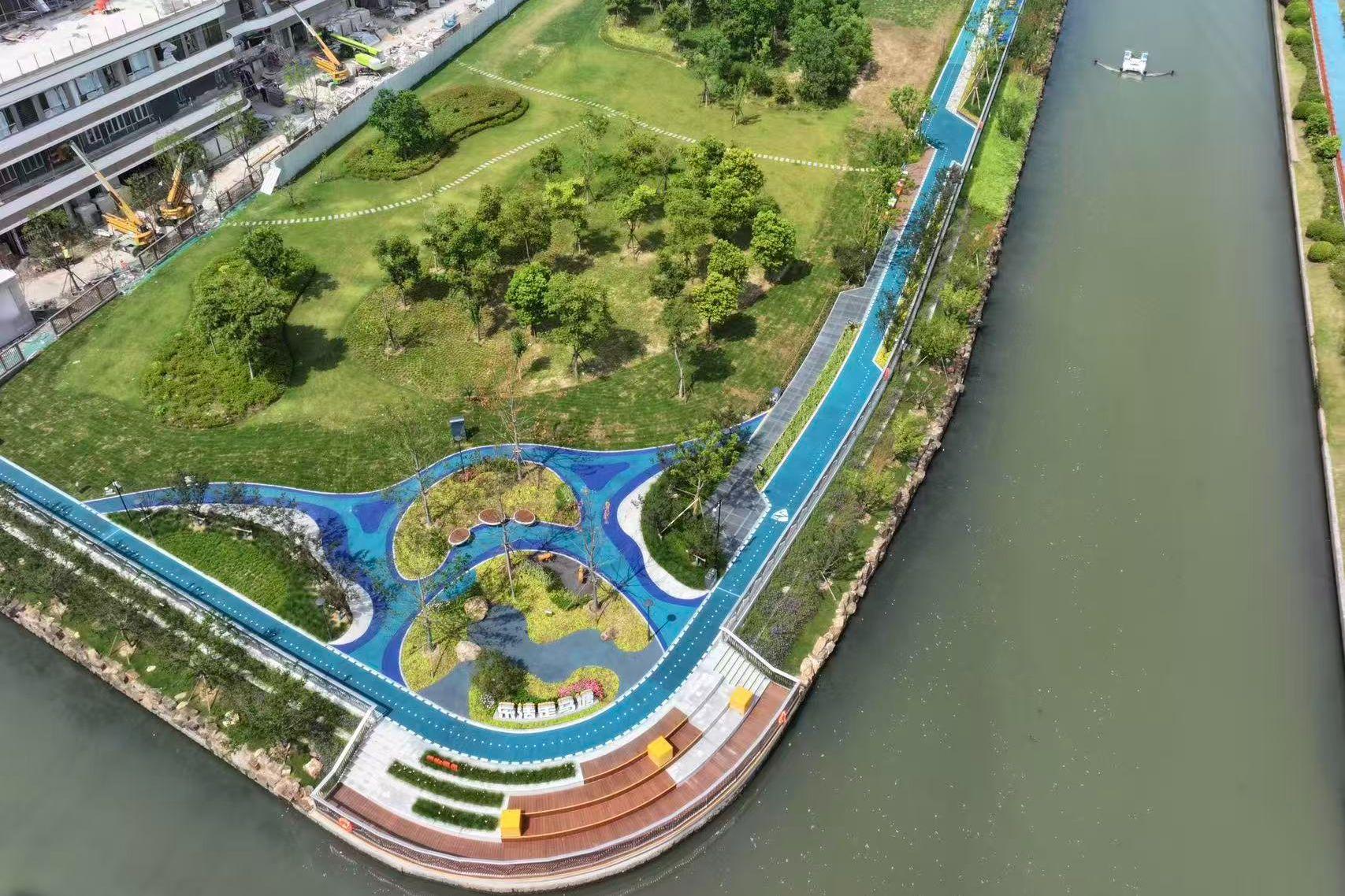
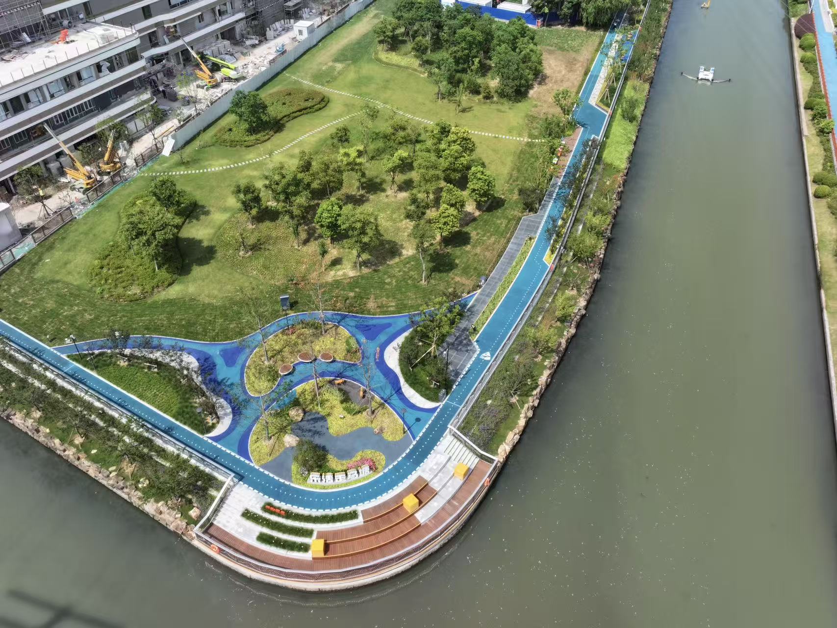
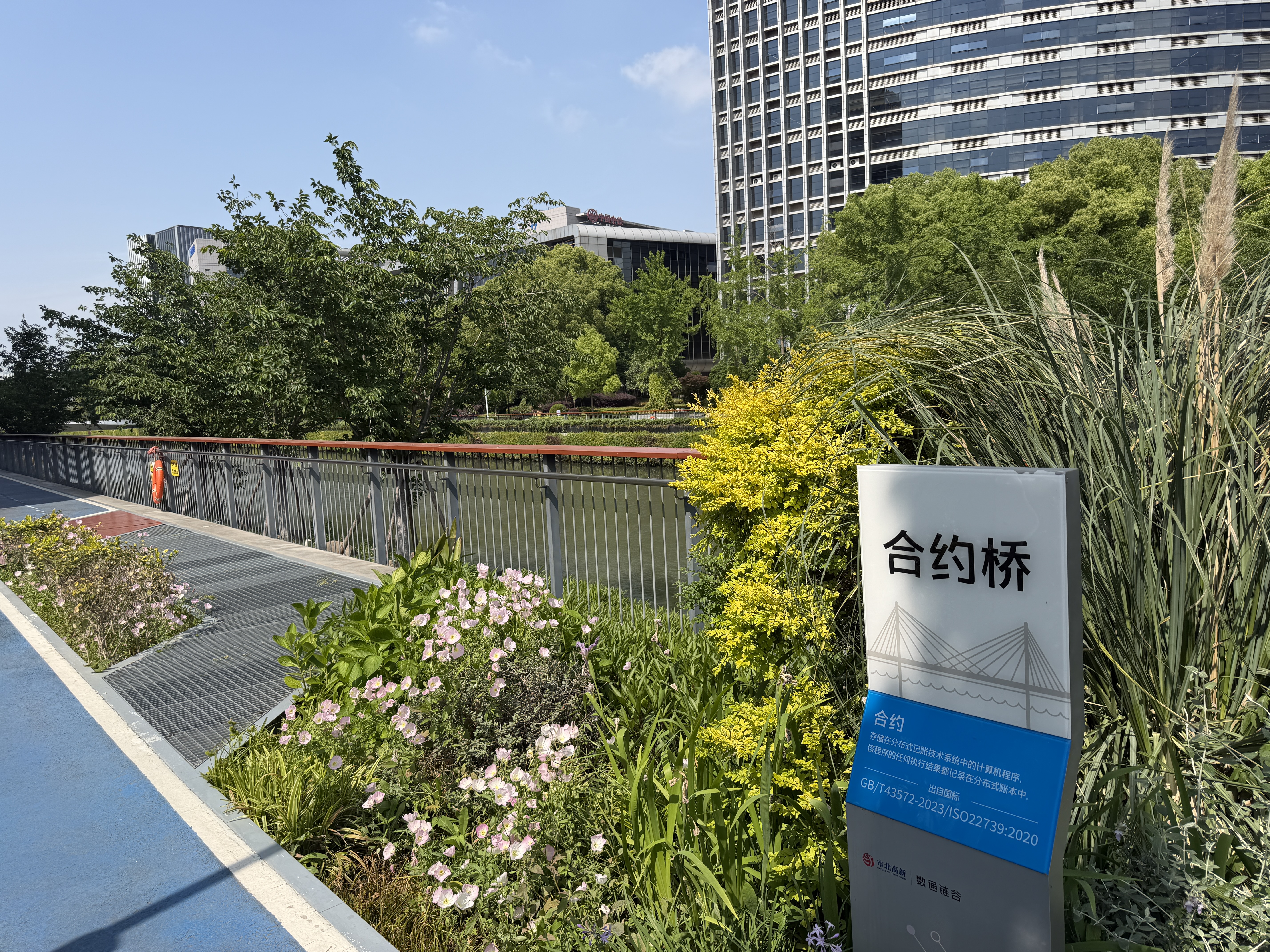
Pengyuepu River: the creative catalyst
As the central diagonal of the Σ, the Pengyuepu River embodies the district's industrial transformation.
Further down the river, decommissioned factories have been reborn as creative hubs. Trendy clusters like the "Meichuang Jingjie" beauty-and-health incubator sit alongside major destinations such as the International Film and Television Park Circum-SHU. This is a dual-track ecosystem where technology and pop culture thrive side by side.
The corridor initiative will stitch together the currently fragmented stretches of the Pengyuepu waterfront, creating seamless, walkable riverside paths that bring residents right to the water's edge.
At its heart lies Daning Park, a massive urban green lung. During the recent Jing'an Flower Festival, the park hosted a 10-kilometer elite race, effortlessly blending sports, nature, and commerce. The strategy here is simple: create an environment so magnetic that it keeps foot traffic and economic activity flowing northward around the clock.
The Pengyuepu waterfront. (Photo by Guo Jingdan)
Suzhou Creek: the cultural waterfront
Forming the bottom stroke of the Σ, Suzhou Creek winds through some of Shanghai's most historically layered neighborhoods.
Along its Jing'an stretch, known locally as Suzhou Creek Bay, century-old industrial buildings have been transformed into avant-garde art spaces. The area has already attracted over 20 major art institutions, including Fotografiska. The renowned Swedish photography museum chose this particular waterfront for its architectural character and creative energy.
The next phase of the plan aims to build on this momentum, reshaping Suzhou Creek into a world-class, walkable waterfront destination that further cements Shanghai's status as an international consumption hub.
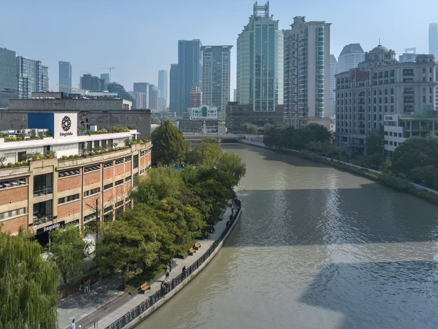
The Suzhou Creek waterfront. (Photo provided by the interviewee)
-- Beyond Jing'an: Shanghai's Great Blue Bet
The Σ Ecological Corridor is no isolated experiment. It reflects a profound paradigm shift in how Shanghai views its blue spaces. The city is moving away from traditional "urban water management" and toward becoming a true "water-managed city" -- where rivers shape life, rather than just cutting through it.
Across the metropolis, the interconnected waterfronts of the Huangpu River and Suzhou Creek now offer over 100 kilometers of continuous public space. Yangpu District has transformed its rusting industrial waterfront into a vibrant "living show belt" and innovation lab. The Xuhui Waterfront (West Bund) has emerged as a powerhouse for artificial intelligence and contemporary art. Putuo District has leveraged its riverbanks to create a wildly popular half-marathon fitness corridor.
In the Pudong New Area, planners are taking this concept even further with an ambitious "Five Rings" water network, which will span approximately 86 kilometers and serve an estimated 2.3 million residents upon its expected completion in mid-2027. This represents a wholesale rewrite of urban governance -- where finance, technology, culture, and daily life converge seamlessly at the water's edge.
The story of Jing'an's Σ Ecological Corridor is modern Shanghai in miniature. It shows how a city can move beyond a mere "geographical merger" on a map to achieve genuine social and economic synergy. By weaving together ecology, industry and daily life, Shanghai is solving a new equation for sustainable urban growth -- one where riverbanks belong to the people, and the city flourishes with its waters.
(Contributed by Guo Jingdan & Gao Pan)
 A single purchase