


The Big Dipper, shaped like a large ladle, is composed of seven shining stars. From the ancient star-guided navigation to the cutting-edge BeiDou Navigation Satellite System, from looking up at the starry sky to transcending time and space, Chinese people have never ceased their efforts in space astrometry over the past thousands of years. With the increasing maturity of China's BeiDou technology, "BeiDou+" and "+BeiDou" services have become the forefront and hot spots leading the building of the Digital Silk Road.
On the shores of Lake Sarez in Tajikistan, the "BeiDou Deformation Monitoring System for the Usoi Dam of Lake Sarez" has been in steady and continuous operation since 2021, acting as a guardian of the lake. Led by the Chinese side, this system was jointly built by multiple entities from China and Tajikistan.
As one of the earliest overseas applications after the opening of BeiDou's global service, the deformation monitoring system is an important model of China and Tajikistan jointly building the Digital Silk Road. While providing support for international cooperation in disaster reduction and prevention, this system has also become an important exemplar of Chinese solutions, technology and wisdom adopted in the global arena.

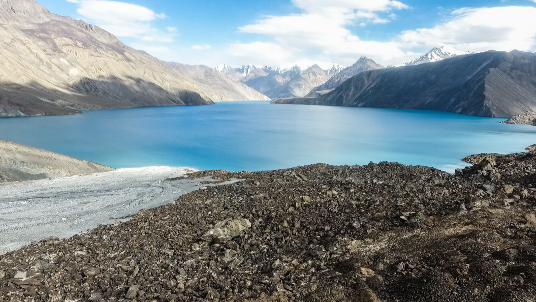
The photo shows Lake Sarez in Tajikistan. (Provided by interviewee)
Pinpoint precision enables millimeter-level deformation monitoring
On July 31, 2020, China's BDS-3 system was officially commissioned. As one of the four major global satellite navigation systems recognized by the United Nations, BeiDou has served users in more than 200 countries and regions around the world, and actively fulfilled international obligations in civil aviation, maritime affairs, search and rescue, and other fields.
"China's BeiDou system has realized and is offering joint operation with other global satellite navigation systems ... and will advance the development of today's navigation, positioning and timing technologies, paving the way for a more flexible, prudent and resilient satellite navigation technology architecture," Simonetta Di Pippo, former director of the United Nations Office for Outer Space Affairs, said in September 2021 at the First International Summit on BDS Applications.
In 2021, a team from the Chinese Academy of Sciences (CAS) brought BeiDou to Tajikistan, and thus this cooperation project on the shores of the scenic Lake Sarez was successfully completed. It was designed to use the BDS-3 navigation system, implemented by the CAS Research Center for Ecology and Environment of Central Asia, supported in terms of technology by the National Time Service Center and the Xinjiang Institute of Geography and Ecology under the CAS, and jointed advanced by Tajik authorities including the National Academy of Sciences, the Agency for Hydrometeorology and the Committee for Emergency Situations and Civil Defense.
The Pamirs witness the deepening of China-Tajikistan cooperation
"Pamir" means "roof of the world" in Tajik. Lake Sarez, located in the Pamir region in eastern Tajikistan, was born in a major earthquake in 1911 and is the highest natural barrier lake in the world. The earthquake-formed Usoi Dam is the world's highest natural dam. As the whole country is in a seismically active zone, the possible failure of the Usoi Dam has long been a great concern for the international community.
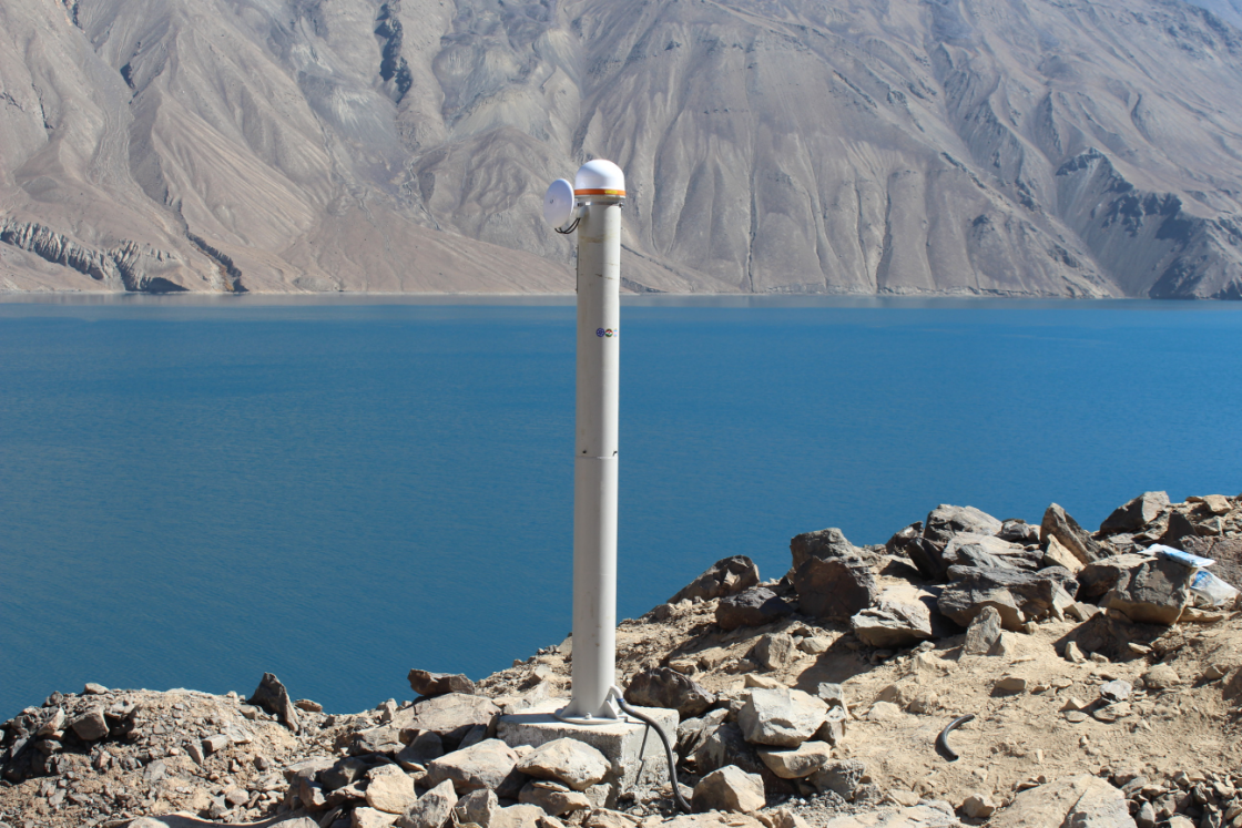
The photo shows one of the monitoring stations of the BeiDou Deformation Monitoring System for the Usoi Dam of Lake Sarez. (Provided by interviewee)
British media have identified it as one of the world's top ten potential natural disasters, and wrote that once the Usoi dam fails, the lake water will engulf parts of Tajikistan, affect Afghanistan and Uzbekistan, impact millions of people, damage the ecological environment in Central Asia, and cause immeasurable loss of life and property. Therefore, it is of great significance to strengthen the monitoring of the dam's deformation.
However, the magnificent Lake Sarez once presented many problems for the project team. The lack of electricity, internet access, roads and people seriously restricted the development of surrounding infrastructure, and the COVID-19 pandemic also stood in the way, making it almost impossible for the project to continue.
Tu Rui, leader of the project and a researcher at the National Time Service Center of the CAS, recalled that to ensure the effect of the project, the CAS team conducted a comprehensive and systematic simulation test of the real field environment in Xinjiang in advance, but after the project was launched in Tajikistan, there were still many difficulties. For example, how to transport the equipment to the dam was a major problem for the project team. "Lake Sarez is at a high altitude and transportation is not easy. You can only climb up the pile of stones. At that time, the helicopters that Tajikistan could use for the transport of equipment were busy with emergency rescue and were always occupied," Tu said.
Nearing October 2021, traffic would be completely disrupted if the Lake Sarez area entered a rainy and snowy season that would last half a year. Anxious about the project, Tu and the Xinjiang team communicated and coordinated with the Tajik side every day. Eventually, the Dushanbe branch of the CAS Research Center for Ecology and Environment of Central Asia organized 30 local staff members and 10 scientific researchers from Tajikistan to develop a solution for transporting the equipment for the monitoring system with 40 donkeys. "It was the end of September 2021. After a huge test, the equipment was finally successfully transported to the dam," Tu said.
On October 8, 2021, monitoring signals of China's BeiDou were successfully transmitted from the shores of Lake Sarez, and the two monitoring stations deployed in the first phase began to provide millimeter-level precision displacement and deformation data for Tajikistan.
In September 2022, the monitoring system was upgraded and expanded, and six monitoring stations were added to the dam area, forming a regional BeiDou monitoring network together with the previous two stations. The upgrade effectively improved the continuity of real-time data acquisition, enlarged the monitoring scope, and boosted calculation stability.
With an average altitude of 3,263 meters, the Sarez Lake area has no conventional power supply. The project team capitalized on the strong sunlight there and designed solar photovoltaic panels and large-capacity battery packs, which can realize steady power supply for the monitoring system even without sunlight for 30 consecutive days. This provided the basic guarantee for the long-term stable operation of the BeiDou monitoring system.
In May 2023, the China-Central Asia Summit was held in Xi'an, and the deformation monitoring system for Lake Sarez received widespread attention as an important example of China-Central Asia cooperation in building the Digital Silk Road and jointly developing the digital economy. It is solid evidence of the deepening and high-quality development of China-Tajikistan and China-Central Asia cooperation.
"Although more than 100 years have passed since the devastating earthquake that caused the formation of Lake Sarez, sustained long-term measures are needed to ensure the safety of the lake," said Majid Gulayozov, executive director of the Dushanbe branch of the CAS Research Center for Ecology and Environment of Central Asia, adding that the establishment of the BeiDou monitoring system can make important contributions to local and international disaster prevention and mitigation, public security and emergency communication support. "The China-Tajikistan joint scientific research project in Lake Sarez is a successful example and will contribute to the further development of cooperation between the two countries," he said.
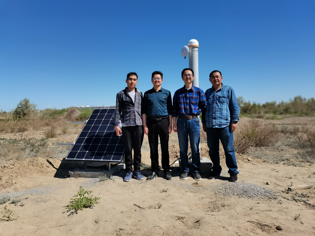
The photo shows Chinese researchers at a simulation test site of the deformation monitoring system in Fukang, Xinjiang. (Provided by interviewee)
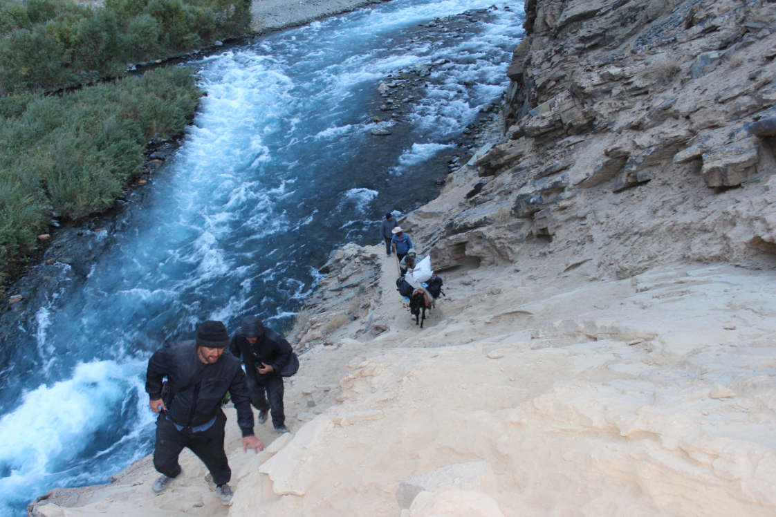
In September 2021, Tajik personnel are on their way to transport equipment for the BeiDou Deformation Monitoring System for the Usoi Dam of Lake Sarez. (Provided by interviewee)
"BeiDou+" improves lives of people from around the globe
On February 23, 2023, a 7.2-magnitude earthquake struck the Murghab region of southeastern Tajikistan, with an epicenter just 52 kilometers from Lake Sarez. Soon after the earthquake, the real-time data transmitted from the dam's monitoring system helped Tajik authorities make efficient and accurate analysis of the disaster.
Promoting disaster prevention and mitigation through scientific and technological means is a major issue bearing on people's lives, and it is also a major responsibility for BeiDou scientists. With the successful implementation of the Usoi Dam project, the role of China's BeiDou in disaster prevention and mitigation has become increasingly prominent, and the new business forms of "BeiDou+" and "+BeiDou" have burst out new vitality in a wider range of fields.
The CAS scientific research team has developed and launched a BeiDou ubiquitous deformation monitoring service platform for the Belt and Road. In addition to the Lake Sarez project, the platform has successively carried out technological demonstrations in Kyrgyzstan's expressway slope monitoring and Tajikistan's avalanche monitoring. It is of great significance for promoting the international application of BeiDou and advancing the economic and social development of the Belt and Road countries.
In recent years, in order to expand the scope and depth of international cooperation on natural disaster prevention and emergency management under the Belt and Road Initiative, China has signed a number of international cooperation documents on emergency management in the field of natural disasters with many countries and international organizations, promoting the realization of international cooperation in emergency management at the strategic level.
"As a major spatiotemporal infrastructure for providing public services to the world, China's BeiDou still has great potential in international cooperation in natural disaster prevention and emergency management. The National Time Service Center will further participate in international disaster reduction and prevention in the Asia-Pacific region and beyond," said Lu Xiaochun, deputy director of the center.

The photo shows the software interface of the BeiDou Deformation Monitoring System for the Usoi Dam of Lake Sarez. (Provided by interviewee)
Things change as the Big Dipper turns time and again. China's BeiDou system has already become a system serving the entire world. As time goes by, it will shine brilliantly on a broader stage and write new chapters of its legendary development. (By Shi Chunjiao, Liu Yu, Zhang Jiye)
 A single purchase