


On September 7th, 2013, the Silk Road Economic Belt was initiated that aims to connect Central Asian countries. The "Belt" route stretches to the Baltic Sea area via Central Asia and Russia, to the Mediterranean Sea area via Central Asia and Western Asia, and to the Indian Ocean area via southwest China.
I. Countries along the Silk Road Economic Belt
5 countries in Central Asia
Kazakhstan, Kyrgyzstan, Tajikistan, Uzbekistan, and Turkmenistan are just across the border from China. They are closely connected with China's economy.
6 countries in Middle-eastern:
Iran, Iraq, Jordan, Syria, Saudi Arabia, and Turkey mainly trade oil and gas. They look forward to developing other industries and agriculture through cooperation with China.

Photo taken on Nov. 20, 2012 shows the duplicate of statues at "The Colors of DunHuang: A Magic Gateway to the SilkRoad" exhibition held in Mimar Sinan University in Istanbul of Turkey. The Exhibition kicked off here on Tuesday. (Xinhua/Ma Yan)
6 countries on the boundary between Europe and Central Asia:
Azerbaijan, Georgia, Armenia, Ukraine, Belarus, and Moldova are expected to achieve economic integration.
Russia is an important part of the Silk Road Economic Belt. It has a close relationship with Central Asian countries, the countries of the Caucasus region, and Western Asian countries.
If the issues in Afghanistan can be resolved peacefully, then the development of Afghanistan, Pakistan, and India will also be promoted by the Belt and Road Initiative.
II. Overview of the Silk Road Economic Belt countries
The following table provides an overview of some countries of the Silk Road Economic Belt.
Country | Region | Income Group |
Afghanistan | South Asia | Low income |
Armenia | Europe & Central Asia | Upper middle income |
Azerbaijan | Europe & Central Asia | Upper middle income |
Belarus | Europe & Central Asia | Upper middle income |
Georgia | Europe & Central Asia | Lower middle income |
Iran | Middle East & North Africa | Upper middle income |
Iraq | Middle East & North Africa | Upper middle income |
Jordan | Middle East & North Africa | Upper middle income |
Kazakhstan | Europe & Central Asia | Upper middle income |
Kyrgyzstan | Europe & Central Asia | Lower middle income |
Moldova | Europe & Central Asia | Lower middle income |
Pakistan | South Asia | Lower middle income |
Russia | Europe & Central Asia | Upper middle income |
Saudi Arabia | Middle East & North Africa | High income |
Syria | Middle East & North Africa | Lower middle income |
Tajikistan | Europe & Central Asia | Low income |
Turkey | Europe & Central Asia | Upper middle income |
Turkmenistan | Europe & Central Asia | Lower middle income |
Ukraine | Europe & Central Asia | Lower middle income |
Uzbekistan | Europe & Central Asia | Lower middle income |
| Country Name | Population | GDP(current US, bln USD) | GDP growth rate (%) | Share of agri in GDP | Share of industry in GDP | Share of goods, service exports in GDP | Share of goods, service imports in GDP | Net flow of FDI (bln USD) |
| China | 1397715000 | 14342.9 | 6.11 | 7.11 | 38.97 | 18.41 | 17.26 | 155.82 |
| Russia | 144373535 | 1699.88 | 1.34 | 3.44 | 32.16 | 28.31 | 20.76 | 31.97 |
| Kazakhstan | 18513930 | 181.67 | 4.5 | 4.46 | 33.02 | 36.23 | 27.66 | 3.37 |
| Kyrgyzstan | 6456900 | 8.45 | 4.5 | 12.08 | 27.6 | 37.38 | 65.69 | 0.4 |
| Uzbekistan | 33580650 | 57.92 | 5.56 | 25.51 | 33.15 | 31.19 | 41.81 | 2.31 |
| Iran | 82913906 | .. | -6.78 | 12.18 | 31.67 | 25.26 | 30.90 | 1.51 |
| Iraq | 39309783 | 234.09 | 4.4 | 1.47 | 49.89 | 38.05 | 39.29 | -3.0756 |
| Jordan | 10101694 | 44.5 | 1.96 | 4.91 | 24.45 | 36.35 | 49.98 | 0.83 |
| Saudi Arabia | 34268528 | 792.97 | 0.33 | 2.23 | 47.43 | 36.04 | 27.61 | 4.56 |
| Turkey | 83429615 | 761.43 | 0.92 | 6.42 | 27.19 | 32.74 | 29.94 | 9.05 |
| Azerbaijan | 10023318 | 48.048 | 2.22 | 5.71 | 48.68 | 49.17 | 36.86 | 1.5 |
| Georgia | 3720382 | 17.48 | 4.99 | 6.5 | 20.31 | 54.81 | 63.82 | 1.34 |
| Armenia | 2957731 | 13.67 | 7.6 | 11.98 | 24.28 | 41.18 | 54.54 | 0.25 |
| Ukraine | 44385155 | 153.78 | 3.23 | 9 | 22.56 | 41.17 | 49.00 | 5.83 |
| Belarus | 9466856 | 63.08 | 1.22 | 6.78 | 31.29 | 66.43 | 66.91 | 1.27 |
| Moldova | 2657637 | 11.97 | 3.58 | 10.05 | 22.77 | 31.4 | 55.98 | 0.5 |
| Pakistan | 216565318 | 278.22 | 0.99 | 22.04 | 18.33 | 10.11 | 20.31 | 2.22 |
(Data source: World Bank)
III. Profile book of the Silk Road Economic Belt countries
Xinhua Silk Road unveils reports on economic figures and facts of the countries of the Silk Road Economic Belt.
For example:
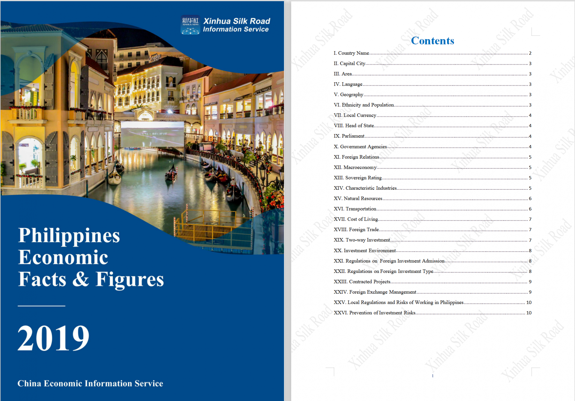
Country name
Republic of the Philippines
Capital city
Metro Manila
Area
299,700 square kilometers
Language
There are about 70 languages in the Philippines. The national language is Tagalog-based Filipino. English is the official language and is more common in the country. All Filipinos who have attended school can speak English.
Geography
The Philippines is located in southeast Asia. Bounded by the South China Sea on the west, the Philippine Sea on the east and the Celebes Sea on the southwest, the Philippines shares maritime borders with China to the north, Japan to the northeast, Palau to the east, Indonesia to the south, Malaysia and Brunei to the southwest, Vietnam to the west, and China to the northwest. With a total area of 299,700 square kilometers, the country consists of more than 7,000 islands, and the coastline is about 18,533 kilometers long. The Philippines is located in the GMT+08:00 time zone. There is no time difference between Philippines and Beijing and the former doesn’t have daylight saving time.
...
For more, you can log onto Xinhua Silk Road Database (https://en.imsilkroad.com/login)
IV. Exports, imports, and FDI of selected countries along Silk Road Economic Belt
Even according to the narrow-definition, countries along the Silk Road Economic Belt bear a significant share of world international trade and cross-bordercapital flows. They accounts for 23.9 percent of the world’s total exports of goods and services, 22.1 percent of world’s imports of goods and services, and 25.7 percent of FDI inflows.
V. industrial structure of selected countries along Silk Road Economic Belt
Economies covered by the Silk Road Economic Belt also havea highly complementary in industrial structureand resource endowment. There are economies in the very early stage of industrialization, like Tajikistan, Kyrgyzstan, Pakistan, and Afghanistan, in which agriculture accounts for over 20 percent of their total GDP. There are also typical manufacturing economies like Germany and China. As for endowment, many of the countries are rich in oil, gas, or mineral resources,while some others have scarce supply of natural resources.
VI. How to connect the countries in the Silk Road Economic Belt
The Silk Road Economic Belt is a long-term vision for the infrastructural development, throughout Eurasia in six corridors: from East Asia to Western Europe and South through Africa.Eurasian connectivity and economic cooperation span six "economic corridors" and connect countries along the silk roadEconomic Belt.
1. New Eurasian Land Bridge Economic Corridor
The New Eurasian Land Bridge (NELB) is an international passageway linking the Pacific and the Atlantic. As distinct from the Siberian Landbridge, which goes from Russia's eastern port of Vladivostok through Siberia to Moscow and onward to West European countries, this "second" bridge goes from China's coastal cities of Lianyungang and Rizhao to Holland's Rotterdam and Belgium's Antwerp. The 10,800-kilometer-long rail link runs through Kazakhstan, Russia, Belarus, Poland and Germany, and serves more than 30 countries and regions.
2. China-Mongolia-Russia Economic Corridor (CMREC)
The China-Mongolia-Russia Economic Corridor (CMREC) has two key traffic arteries: one extends from China's Beijing-Tianjin-Hebei region to Hohhot and on to Mongolia and Russia; the other extends from China's Dalian, Shenyang, Changchun, Harbin and Manzhouli to Russia's Chita.
Seven major areas of cooperation are envisaged: transport infrastructure and connectivity; port construction, and customs and border inspection and quarantine services; industrial capacity and investment; trade; cultural and people-to-people exchanges; environmental protection; and cooperation with adjacent regions. Transport is the main focus.
3. China-Central Asia-West Asia Economic Corridor (CCWAEC)
The China-Central Asia-West Asia Economic Corridor (CCWAEC) links China and the Arabian Peninsula. The vast region it covers generally follows the trajectory of the ancient Silk Road.
The corridor starts from China's Xinjiang and traverses Central Asia before reaching the Persian Gulf, the Mediterranean Sea and the Arabian Peninsula. It crosses five Central Asian countries (Kazakhstan, Kyrgyzstan, Tajikistan, Uzbekistan and Turkmenistan) and 17 countries and regions in West Asia (including Iran, Saudi Arab and Turkey).
4. China-Indochina Peninsula Economic Corridor (CICPEC)
The China-Indochina Peninsula Economic Corridor (CICPEC) extends from China's Pearl River Delta westward along the Nanchong-Guang'an Expressway and the Nanning-Guangzhou High-speed Railway via Nanning and Pingxiang to Hanoi and Singapore.
This land bridge links China with the Indochina Peninsula and crosses the heart of Vietnam, Laos, Cambodia, Thailand, Myanmar and Malaysia. It is expected to boost China's cooperation with the ASEAN countries.
5. Bangladesh-China-India-Myanmar Economic Corridor (BCIMEC)
The Bangladesh-China-India-Myanmar Economic Corridor (BCIMEC),with the objective of linking the two huge markets of China and India and enhancing regional connectivity.
6. China-Pakistan Economic Corridor (CPEC)
China-Pakistan Economic Corridor, The 3,000-kilometer-long corridor starts from China's Kashgar and ends at Pakistan's Gwadar, and connects the Silk Road Economic Belt in the north and the 21st Century Maritime Silk Road in the south. It is a trade network of highways, railways, pipelines and optical cables, and a flagship project under the Belt and Road Initiative.
CPEC will not only benefit China and Pakistan but will have positive impact on Iran, Afghanistan, India, Central Asian Republic, and the region. The enhancement of geographical linkages having improved road, rail and air transportation system with frequent and free exchanges of growth and people to people contact, enhancing understanding through academic, cultural and regional knowledge and culture, activity of higher volume of flow of trade and businesses, producing and moving energy to have more optimal businesses and enhancement of co-operation by win-win model will result in well connected, integrated region of shared destiny, harmony and development.
China-Pakistan Economic Corridor is journey towards economic regionalization in the globalized world. It founded peace, development, and win-win model for all of them.
VII. Chinese provines and regions along the Silk Road Economic Belt
5 provinces and regions in northwestern China:
Shaanxi, Gansu, Qinghai, Ningxia Hui Autonomous Region, Xinjiang Uygur Autunomous Region
4 provinces and regions in southwestern China:
Chongqing Municipality, Sichuan, Yunnan, Guangxi Zhuang Autonomous Region
Shaanxi is situated at the geographical center of China. A one-day circular drive around Xi’an can cover a population of several hundred million. Shaanxi is the main gateway to Northwestern China from central and eastern regions, and the main channel from Northern China to southwestern regions. It is an important and convenient place connecting the economically developed eastern region and the resourceful western regions.
As the starting point of the ancient Silk Road, Shaanxi province firmly understands the opportunity of building the modern version, is an exemplary starting point for it and by exploiting its natural advantages is positioned to be the “one belt and one road” bridge tower.
Bordering central Asia and as a gateway to Eurasia, west China's Xinjiang Uygur Autonomous Region is the core zone on the Silk Road Economic Belt.
Guangxi is an important region for cooperation between China and ASEAN because it connects the Silk Road Economic Belt and 21st Century Maritime Silk Road. Guangxi recently improved transportation to and from its ports by opening a railway that connects Yulin city with Tieshan Port as well as connects the ports of Fangcheng, Beihai, Qinzhou and Tieshan to each other.
 A single purchase